Sunday, January 31, 2010

Water Vapor Responsible for Slowing of Global Warming?


Recent research has found that the slowing of global warming in recent times may be attributed to global warming. According to the journal Science, over the last decade, the amount of water vapor in the stratosphere has dropped around 10%. This in turn has slowed the rate of global warming by 25% in the same amount of time. This discovery has led to two different arguments. One is that of those who are not quite sure global warming really exists, who say that this supports their argument. The other is that of those who think global warming is still a long term problem and this discovery is just a minor roadblock for global warming, the rate of which will rise again soon.
Since water vapor is the most prevalent greenhouse gas and it amplifies the effect of other gases, like carbon dioxide, the theory that water vapor affects global warming makes sense. However, this discovery is just the tip of the iceberg in terms of the damage already done by global warming and reversing the effects of it. More research needs to be done to determine exactly what can be done to prevent global warming.

source: "Slowdown in Warming Linked to Water Vapor" by Gautam Naik, Wall Street Journal
http://online.wsj.com/article/SB20001424052748704194504575031404275769886.html

Stationary Front

Since we aren't really going to go into detail about them in class, I thought it might be cool to see what stationary fronts are all about.  A stationary front is a front that has stopped any sort of movement, because two air masses have met and cancelled each other's movement out.  From there, the fronts can either just die out, or can break away from one another and continue to move.  Once the movement is continued, the front is no longer stationary, and will most likely become either a warm front or a cold front.  A stationary front is represented by a red half circle, and an upside-down blue triangle, one after the other.  Since a stationary front occurs when two fronts are canceling each other out, the weather systems or also in a way canceled out.  Temperatures in stationary fronts are moderate, and there is little wind.  If wind were to pick up from one of the air masses, the front would continue to move, and therefore no longer be stationary.
http://www.windows.ucar.edu/tour/link=/earth/Atmosphere/tstorm/stat_front.html

Harmful ozone from Asia is being sent across the World

Smog above Los Angeles (pictured left)

Emissions of gases like nitrogen oxides are one of the sources of harmful ozone in the troposphere. Scientists monitored the level of these gases from 1996-2005 and found that there was a decrease in emissions of nitrogen oxides from Europe and North America, but an increase from industrializing nations in Asia, such as China. However, today the levels of harmful ozone above North America are higher than estimated, so scientists from Earth System Research Laboratory in Boulder, Colorado set out to discover what's happening. The scientists discovered that America may be importing something just as dangerous as lead tainted toys from China, harmful ozone. They discovered that air masses that had the greatest chance of having passed near east and south Asia were found fifteen days later over areas in America that showed the largest increase in ozone concentrations. I found this news interesting because it connected to the article we read about in class about pollution in Asia, in which the authors said that in a short time we might experience pollution from China in America. However, it seems like that time has already come.

Clouds!-Weather Unit Post

I thought since we haven't looked a lot at different types of clouds it would be interesting to learn about them.

There are many different types of clouds but the 4 main types are: Stratus (low clouds), Alto (middle clouds), Cirrus (high clouds), and Cumulus (clouds with vertical development.

1. Stratus Clouds

-Stratus clouds are the lowest, usually below 6,000 feet. They are large grayish clouds that usually cover a lot of the sky. There is usually no precipitation associated with stratus clouds. They resemble fog that hasn't reached the ground.


-Nimbostratus clouds are the other type of stratus cloud that are a darker gray and usually
produce light rain or snow. It is usually hard to see the edges of this cloud.


2. Alto Clouds

-Altocumulus clouds made up of water droplets and are found at usually 6,500 to 23,000 feet. They are grey or white, puffy, and can appear in waves or bands. One part of the cloud usually appears darker than the rest. They are associated with thunderstorms.


-Altostratus clouds are made up of water droplets and ice crystals and tend to be grey to blue-gray in color. They are usually thin and cover most of the sky. They also precede storms that will have lots of precipitation.


3. Cirrus clouds

-Cirrostratus clouds are very thin clouds that allow the sun and moon light to penetrate through them. They are found usually above 20,000 feet. The clouds are usually white and are associated with good weather.


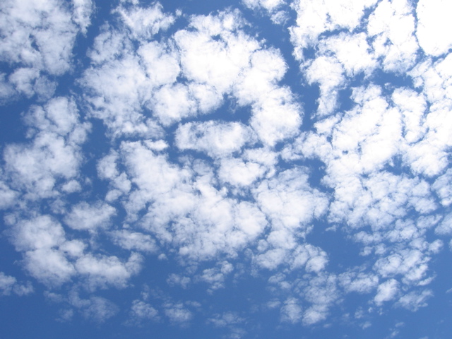
-Cirrocumulus clouds are groups of small little puffy clouds that appear as little splotches in the sky. Because they can resemble fish scales they have gotten the nickname of "mackerel sky". These clouds are usually seen in winter time and indicate good but cold weather.


4. Cumulus Clouds

-Cumulus clouds are large puffy clouds that usually have a flat base. They are the stereotypical white, fluffy, & cottony cloud.


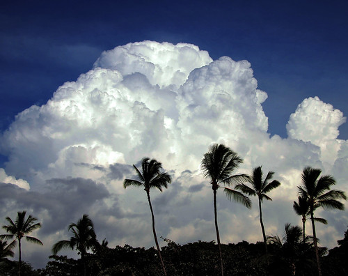
-Cumulonimbus clouds are cumulus clouds that grow vertically and become very tall. These clouds are typically thunderstorm clouds but are also associated with lightning, thunder, and tornadoes.

Thursday, January 28, 2010

Frankenstorm

Scientists at the California Institute of Technology have created a model of what they call the Frankenstorm, and it is much worse than the recent rough weather California has faced.  Experts want to be prepared for what could happen with the climate changing.  The storm could drop as much as 8 feet of rain on the state.  The storm, frighteningly enough, is unlikely, but possible to occur.  Scientists used recent storm systems, as well as an especially strong system from over a century ago, to create the model.  The storm system would brew in the Pacific, and hit Southern California as hard as a hurricane would.  The system would then stall (possibly from a stationary front?) for over a week, until another storm system would meet up with this one and cause even more rain.  Experts say the storm would be similar to severe flooding that occurred in California in 1861-1862, which were so damaging that the capital of California had to be temporarily moved from Sacramento to San Francisco.  The governor at the time had to attend his inauguration by rowboat.  Hopefully the storm remains as fictional as the character it takes its name from, Frankenstein.
http://news.yahoo.com/s/ap/20100124/ap_on_sc/us_sci_frankenstorm_scenario


http://yahyasheikho786.files.wordpress.com/2009/09/hurricane.jpg

Ozone Hole Healing Could Cause Further Climate Warming


Though the Antarctic ozone hole is slowly closing, which was once thought to be a good thing because it was once considered one of the biggest environmental threats, it is actually causing warming in the southern hemisphere. Scientists have found that the hole actually helped shield the Antarctic area from the carbon-induced warming over the past 20 years. This happened through high speed winds beneath the hole leading to the formation of brighter clouds during Antarctica's winters. The wind blew water particles from the sea into the air, where they form droplets and, later, clouds. These clouds reflect some of the sun's powerful rays. Aerosol, a particle in the air also helps against greenhouse gases by reflecting heat back into space instead of just into the atmosphere. However, these winds are dying down, which could lead to the areas exposure to CO2 emissions (which would warm the area). Scientists are continuing to study this area for more predictions.

http://www.leeds.ac.uk/news/article/700/ozone_hole_healing_could_cause_further_climate_warming

AND... I found the Partly Cloudy short film!!
http://www.youtube.com/watch?v=UV7HO9FazkI

Wednesday, January 27, 2010

The Affects Pressure Changes Have on Our Bodies


Since we are currently studying how high and low pressure fronts differently affect the weather, I thought it would be interesting to see how these barometric pressure changes affect us personally. Scientists have found that changes in weather often cause headaches and migraines. No one knows exactly why this happens, but there are many theories. Changes in pressure cause changes in oxygen levels and therefore some believe that blood vessels in our heads expand or contract to compensate and this causes us discomfort. Other researchers believe that it's not pressure alone, but a variety of weather factors together that trigger migraines. A study conducted in 1981 found that the severity of migraines increased when individuals were exposed to weather with low pressure, which is a passage of a warm front, causing high temperatures and humidity. There was also a study led by Dr. Galina Mindlin of Jefferson Medical College in Philadelphia which found that migraines are likely not only when pressure rises, but also when the temperature rises due to the electrical charge of the air. Who knew that changes in pressure could affect our bodies in addition to our weather!

Tuesday, January 26, 2010

Mountaintop Mining


There is a new operation taking place in the Appalachian mountains called "mountaintop mining". Miners are essentially going through and almost scraping off the tops of the appalachian mountains little by little in order to gather coal and to look for new, or renewed, resources. The exact procedure is not entirely available to the public (people outside of the mining industry) because it is such a contraversial operation. People are criticizing this operation because they believe it will destroy the appearance of the mountains, and if too many useful resources are found there, then what will stop the miners from digging all the way through and destroying the entire mountain range? Nothing will stop them; and that is the biggest issue at hand. The restrictions of this operation are currently set so that beautiful features won't be destroyed, but who knows what will happen if in the futue, that is our only source of coal; people will care more about energy sources than the beauty of our country and mountaintop mining might permanently alter the structure of many land features.

Black Holes As Fuel


A few weeks ago the Large Hadron Collider starting smashing together particles to see what would happen. Many scientists hope that very tiny black holes will be created- they will vanish almost instantly and not be any danger, but very helpful to study all the same if they do occur. One author suggests that black holes are critical to the future of mankind. General consensus is that long range space travel would require more fuel than earth can reasonably provide. One theoretical solution is to power starships with the power of tiny black holes. The reasoning as that since black holes produce more energy the smaller they are, an atom sized one would provide incredible energy. At this stage, it is entirely theoretical.


How does a Lightning rod work?


Many people install lightning rods on their rooftops to prevent homes from the damage that lightning may cause. Generally, a lightning rod is nothing more than a conductive piece of metal about 3 feet in length on top of the highest point on a house. Attached to this piece of metal is a thick copper wire that runs down the side of the house and attaches to a pipe, which reaches several feet into the earth. During a storm as the charge builds, the air between the cloud and the ground starts to ionize, once it gets to within 100 feet of the ground objects on the ground begin throwing up “streamers”. When lightning strikes and your lightning rod created a higher streamer than your rooftop, the odds of it striking the rod are greater. Therefore, you would have decreased the odds of the lightning damaging your home.


http://www.weatherimagery.com/blog/lightning-rods-attract-lightning/

Monday, January 25, 2010

More Hurricanes Than Ever Before

Global Warming has been proven over the past few years and now scientists are starting to study what the effects of global warming will be. The Atlantic ocean has increased .65 degrees F over the past 90 years and scientists have now discovered that the number of hurricanes per year in the Atlantic ocean have now increased substantially.

A STORMY UPSWING

A new study finds that the average number of hurricanes each year has jumped during the past century:

Period studied Hurricanes per year
1905-30 3.5
1931-94 5.1
1995-2005 8.4

Source: Philosophical Transactions of the Royal Society A


http://www.usatoday.com/weather/hurricane/2007-07-29-more-hurricanes_N.htm

Last Decade is the warmest on record


Despite attempts of many nations to curb their emissions of greenhouse gases new NASA data shows that the last decade is the warmest decade on record, with 2005 being the warmest year ever recorded. Per decade the global temperature has risen .36 degrees F and in total average global temperatures have increased around 1.5 degrees F since 1880. Scientists hypothesize that global temperatures are on a path to rise by an average of 6C by the end of the century. Experts say that such a rise would have irreversible consequences for the Earth, making large parts of the planet uninhabitable. Lets hope our world leaders can find ways to curb greenhouse gas emissions more successfully in the coming years!


http://www.sciencedaily.com/releases/2010/01/100121170717.htm

Nation's Weather Forecast

This article is a summary of the national weather forecast for the upcoming week. With the information we learned in class I now have a greater understanding of the terms they use.

They predicted in our region (Great Lake) that a low pressure system is to move in. In result warm air would come from the south and bring some precipitation. Also cold air would be pulled in from Canada the mixture of the warm and cold air would create precipitation in the form of snow.

In the West they are prediction a cold front resulting with rain showers. A cold front is when a mass of cold air replaces a mass of warm air.

The High plains are predicting blizzard conditions due to an increase in wind and cold temperatures.


http://www.washingtonpost.com/wp-dyn/content/article/2010/01/25/AR2010012500432.html

Friday, January 22, 2010

Get yo filthy ozone up outta here!


http://www.sciencedaily.com/releases/2010/01/100120131252.htm

Springtime Ozone Increases Above Western North America Linked to Emissions from Abroad

As winter begins to decline and spring weather is in near sight, (well, sorta), that means springtime ozone levels will continue their usual trend of rising. For the longest time, scientists weren't really sure why...until now.

Pollution originating in Asian countries has somehow found its way across Asia, Europe, and the Atlantic Ocean to the United States where officials are now having more trouble than ever enforcing the Clean Air Act. While in the country the air may be at a certain standard, international filth is making that standard a little difficult to keep normal.

US scientists used appx. 100,000 ozone observation crafts to come to the conclusion that although the US certainly adds to the rising ozone levels, the recent increase isn't the fault of the states.

By analyzing different locations of ozone pollution and wind patters, scientists noticed that springtime ozone levels were especially high when prevailing winds came from the East, (when the winds weren't from that direction, ozone levels were still high but not to the same extent).

After further analysis, officials discovered "an overall...increase in springtime ozone of 14 percent from 1995 to 2008" (Science 1). Now, this isn't to say Asia is the reason of this, but this is under further investigation. But for now, we're going to blame them.

I find this article interesting because I always knew an economy was connected internationally, but now I know that the economy's after-products like waste and pollution are too playing a part in global interaction. For every plus, there's a minus. The plus is the international economy (not that it's doing well or anything) and the miuns would be the pollution that is infultrating our air.

Boo ozone.

Wednesday, January 20, 2010

Current Events


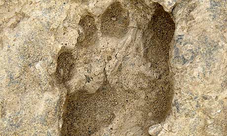
A new report shows that four legged mammals may have come out of the water and on to land much earlier than was previously thought. Some fossilized footprints show four legged creatures on land 397 million years ago. Scientists had originally thought this development occured somewhere around 385 million years ago. The difference is enourmous in scientific terms. It totally changes the notion of how animals evolved, and scientists are being forced to reconsider their thinking. Fully developed theories on the progress of evolution have to be thrown out when this new evidence is considered. Currently, the biggest goal of many researchers is to find more fossilized evidence to support this theory, to be completely sure.

Sunday, January 10, 2010

Earthquake Wave Comparison

Body waves ( P and S )--------------Surface Waves ( R and L )
/
-small amplitude -------------- ----------large amplitude
-short wavelength----------------------- -long wavelength
-travel more quickly -----------------------travel slowly
-produced by all earthquakes
----------------------------------------------------------------------

P waves------------------------------ S waves

-fastest waves---------------------- -slower
-travel through everything---------- -travel only through solids
-move w/ wave direction--------------moves perpendicular w/ wave direction
-back and forth ---------------------- -side to side
----------------------------------------------------------------------

Friday, January 8, 2010

7.2 Earthquake


Rendova and Tetepare islands in the Soloman islands are in need of aid after a series of earthquakes caused a tsunami and landslide on Monday. The tsunami was sparked by a magnitude 7.2 quake about 9.30am local time. Earthquakes have continued in the region since, including a 6.9 aftershock on Tuesday night. The aftershock is not believed to have caused any further damage. No deaths were reported. Photographs taken from police helicopters show debris lining the shore and damaged houses on the coasts of Rendova and Tetepare, plus damage caused by landslides. There are reports that up to 200 homes have been destroyed on Rendova.. A spokeswoman for the National Disaster Management Office said yesterday that the village of Bainara, on Rendova, was the worst hit, with 16 homes destroyed, and 60 damaged. About 1400 people had been affected, more than a third of Rendova's population.

http://www.stuff.co.nz/world/south-pacific/3210282/Aid-for-Solomon-earthquake-victims

Silicon Quake


Silicon Valley is home to many of America's largest technology companies including Google and Cisco. Even with thousands of the smartest programmers and engineers in the world, Silicon Valley was unable to prevent an earth quake that struck Thursday morning. A light 4.1 earthquake shook this Northern California city. The USGS said the quake, struck at 10:09 a.m. local time was at a depth of 5.6 miles. There have been no reports of major damage or loss of life. This earthquake was a strong reminder of the constant threat of earthquakes. In California especially, the nubmer of faults make the chances for a large earthquake that much greater.

Thursday, January 7, 2010

Magnitude 4.1 Earthquake Hits US Silicon Valley

The US Geological Survey reported that at 10:09 this morning an earthquake measuring 4.1 on the Richter Scale hit the Silicon Valley area (which is in California). So far there have been no reports of damage or injury but after shocks were felt as far away as San Francisco. These ranged in magnitude from 1.5 to 2.2.

I also found a You Tude video explaining what the impact could be if this area experienced a larger earthquake. It's boring (it's just of someone taking a video of a highway near the Silicon Valley area) but the guy says if a large earthquake were to occur there, it could cost the US more money than Hurricane Katrina did. We'll see what happens in the future...

http://www.youtube.com/watch?v=k9MkKo_EZA

http://news.xinhuanet.com/english/2010-01/08/content_12773267.htm

New Galaxies Found


The Hubble Space Telescope has discovered some new galaxies, which may be the furthest away from earth ever discovered. There are three of these new galaxies, all of which are about 13.2 billion light years from earth. However, there is some uncertainty as to if they are really that far away, or only very dim. These were sighted using the Hubble Ultra Deep Field telescope. The findings can only be confirmed as far away galaxies when the next version of the Hubble, the James Webb Space Telescope, is launched in 2014.

http://www.sciencenews.org/view/generic/id/52404/title/New-found_galaxies_may_be_farthest_back_in_time_and_space_yet

Sun and Moon Responsible for Earthquakes?


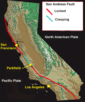
According to a new study at UC Berkley, earthquakes that start deep underground are caused by water that is controlled by the sun and the moon. This could potentially lead to better understanding on earthquakes in general. This information was found by scientists studying the San Andreas fault, which is responsible for many major earthquakes. They discovered that underground water has the same movement as the tides that cause tremors far below the actual epicenter of earthquakes. While more research is definitely needed to see if this actually makes sense, these scientists have a decent start even though this hypothesis seems slightly ridiculous in my opinion.

http://www.foxnews.com/scitech/2009/12/27/sun-moon-responsible-earthquakes/

Earthquakes and Their Aftershocks


When an earthquake occurs a big shock happens. This is the actual earthquake itself and is usually the most damaging part of the earthquake. After this initial shock of the earthquake there are usually parts of the earthquake that come after called aftershocks. These aftershocks can be deadly and on occasion they last for a very long time. Such as the aftershocks after the earthquakes in 1811 and 1812. These aftershocks kept on happening for as long as 100 years after the initial earthquakes. This 100 year aftershock is not usually common, but aftershocks following an earthquake are. Most people do not think about aftershocks when talking about earthquakes, but they are common and can be just as devastating.

How to Prepare Your Home for an Earthquake in 1989


Somethings you can do to prevent your microwave from flying across the room and hurting someone, is to velcro it to the counter. If you are worried about your cans falling off the shelves you can string a wire across the top of the counter stopping the cans from falling off. Another thing you can do is to bolt your stereo to the wall. This has an added bonus of making it almost impossible to steal! You can use the same trick with the books on your shelves as you did with your cans. For your computer, you can use a velcro leash to leash it to the desk and keep it from falling and hurting someone. In the case of an earthquake you need to shut off you gas, you should keep a wrench attached to your gas line to turn it off in the case of an earthquake. You just need to turn it a quarter turn and it turns off, preventing fires. Those are all things you can do to help your home in an earthquake in 1989.

Wednesday, January 6, 2010

Unit Post Earthquakes: 1960 Great Chilean Earthquake


The largest earthquake ever recorded occurred on May 22, 1960 at 7:11. It's magnitude was measured at a 9.5. The quake caused tsunamis and landslides which contributed to the death toll. And the aftershocks which reached as high as 7.9, definitely could have triggered the eruption of the volcano Pueyhue, which erupted only 2 days later. They estimated that all of these forces combined killed 1,655 people, with 3,000 injured and 2,000,000 homeless. It caused damage in southern Chile, Japan, The Philippines, Hawaii, and the United State's western coast.


The quake occurred over the subduction zone between the South American (oceanic) and Nazca (continental) plates. The epicenter was on the ocean floor, approximately 100 miles off of the coast of Chile, which is right over the plate boundary.


Sources:

http://earthquake.usgs.gov/earthquakes/world/events/1960_05_22.php

http://earthquakes.suite101.com/article.cfm/worlds_strongest_earthquake

Tuesday, January 5, 2010

Review of Death By Black Hole


Death By Black Hole by Neil deGrasse Tyson is a book in chapters describing all aspects of the physical sciences. It is a very enjoyable read, as Tyson manages to keep it informative but still somewhat understandable and entertaining. He goes in to depth on almost every science mystery I could have ever thought of. Sometimes, he goes in to too much depth, and it becomes very difficult to understand, as he is an expert in the fields. But for the most part, he uses easy to understand metaphors and analogies to help make it easier to comprehend tough topics. From gravity, to the earth, to the dimensions, to the universe, to light and sound, etc. Tyson covers every topic. I reccommend it to anyone interested in the mysteries of the universe, and doesn't want extremely technical explainations.


Ice Quakes


Ice Quakes


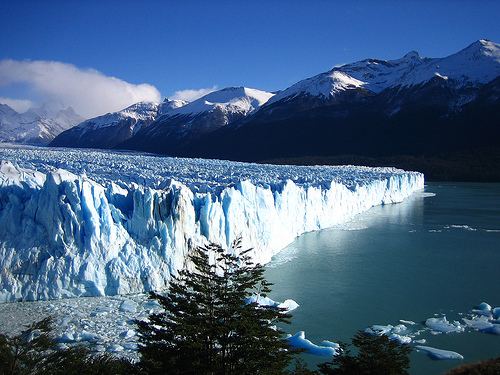
Ok so I was looking up earthquakes and I randomly see this thing on what they called ice quakes. So look farther into it and it turns out that glaciers can have mini quakes! Because of fluctuations in temperature ice can crack and shift quickly, this causes what feels a little bit like a mini earthquake. Although most of these ice quakes are very unnoticeable over a long period of time, some you can feel. I dont know, I thought it was kind of cool.

The West Mata Volcano


West Mata Volcano

Recently there was an underwater volcano discovered in an area in the pacific around Fiji, Tonga and Samoa. The reason this volcano is so special, at nearly 4000 feet below the surface, it is the deepest volcano ever found. NOAA captured this on camera. Because the pressure that far down is so great, the eruption is compressed. This means the camera can get within feet of the eruption, capturing detailed pillows of lava. The West Mata Volcano is also producing boninite lavas, believed to be among the hottest on Earth in modern times, and a type seen before only on extinct volcanoes more than one million years old. The West Mata volcano gives them the opportunity to study magma formation at volcanoes, and to learn more about how Earth recycles material where one tectonic plate is subducted under another.

WATCH THE ERUPTION
http://www.youtube.com/watch?v=FCH6dVcxL3c

Soarce
http://geology.com/press-release/west-mata-volcano/

The Power of Earthquakes


Anytime I hear there was an earthquake I wonder how big it is. Usually Somebody will say 4.0 or 5.0 and I think no big deal. Right?


I was reading an article and the title said 1000 lose their homes, so I just assumed that it must have been a big earthquake. Instead it was just a 5.5 magnitude earthquake. Reading this exposed me to a whole new idea of earthquakes. They are an insanely powerful force and if a big earthquke hit near Chicago then we are in big trouble.


World's Tallest Building


So I'm sure all of you have heard at least something about Dubai and their tallest building, Burj Khalifa. Well if you haven't, you probably live under a rock, Dubai has just recently opened the next tallest building in the world. It stretches up a half-mile with at least 160 stories, unfortunately the exact height has yet to be reported, though it is rumored to be about 2625 feet (800 meters). Let's compare this to the Sears, Willis, Tower:

Sears, Willis, Tower is 108 stories where as the new Dubai tower is 160 stories. That's a whole 52 story difference, which is insane. The Sears Tower is 1,450 feet (442 m) which is 1175 feet short of meeting the Dubai Tower.

Now I can only imagine this new tower wobbles quite a bit, which would be very scary if an earthquake were to occur. The destruction would be pretty intense, luckily though I'm pretty sure they don't get very many earthquakes in the Dubai area.

San Andreas Fault Weakening?


Scientists who have been collecting data for the San Andreas fault line for over two decades noticed that after the Sumatra earthquake in 2004 (the one that triggered the tsunami) the San Andreas fault has weakened. When a fault line weakens, it has more frequent earthquakes, but the earthquakes are of a much lower magnitude. When it weakens, "you only have to push a little bit and the fault fails", says Dr. Taira from Washington DC's Carnegie Institution. So, earthquakes on one side of the world are affected by the strength of earthquakes on the other side of the world. Apparently, this pattern can help predict future earthquakes.

http://news.bbc.co.uk/2/hi/science/nature/8283873.stm

Deadliest Earthquake


Interestingly, the deadliest earthquake is not the strongest earthquake. At 3:42 a.m. on July 28, 1976 , a magnitude 7.8 earthquake hit the city of Tangshan, in northeastern China. It obliterated the city and killed over 240,000 people.

The entire earthquake lasted approximately 14 to 16 seconds. Once the quake was over the entire city was levelled. The medical centers were destroyed as well as the roads to get there. Survivors were faced with no water, food, and electricity. That afternoon a 7.1 magnitude aftershock hit. After the earthquake hit, 242,419 people lay dead or dying, along with another 164,581 people who were severely injured. In 7,218 households, all members of the family were killed by the earthquake. Ninety-three percent of residential buildings and 78 percent of industrial buildings were completely destroyed. Eighty percent of the water pumping stations were seriously damaged and the water pipes were damaged throughout the city. Fourteen percent of the sewage pipes were severely damaged. After the disaster Tangshan received the nickname "Brave City of China."

http://history1900s.about.com/od/horribledisasters/a/tangshan.htm

Real Time Earthquakes


On the USGS website there is a section called the Earthquake Hazard Program. It is available to anyone and it tells you all about recent earthquake activity. you can see maps, seismogram displays, animations, and even things in real time. It is a very cool website to go and check out. while I was looking at it I found that there was a earthquake in Alaska less than an hour ago as I'm writing this. This is a very good website if you want to learn more about earthquakes and what is going on now in the world regarding them.

http://earthquake.usgs.gov/

Monday, January 4, 2010

Earthquake Safety Tips

Although we live in a placid area of the country when it comes to earthquakes, that does not mean that earthquake safety should be neglected. Two of our very own classmates experienced an earthquake in California over winter break, suggesting that everyone regardless of their geographic region should know the basic earthquake safety tips. I have omitted the obvious ones because I have faith in your intelligence. After writing this, I see that Sarah has also done a great post on this topic. You can never have enough safety information in my opinion!

1. If you are indoors during an earthquake, do not immediately run outside! The danger of immediately going outside is being hit by a falling object. Crouch under a strong and steady object and wait until after the ground motion has stopped.
2. Leave the building no matter what afterwards. There may appear to be no damage but there may be underlying cracks and collapses not visible to the eye.
3. Keep in mind that after an earthquake you may not get cellular reception for quite awhile. Do not panic! The phone lines are very busy. When I was in California during an earthquake, I couldn't call home to tell them I was okay for almost an hour.
4. Turn off any major appliances. Turn off the gas at the meter if possible.
5. Remain calm! As destructive as earthquakes are, they are apart of our beautiful blue planet!

http://geology.com/articles/earthquake-safety.shtml

Earthquake in the Solomon Islands


The article I read discussed an earthquake which hit the Solomon Islands about 20 hours ago. The Solomon Islands are located on the Pacific Ring of Fire, which experiences a lot of seismic activity. In 2007 the Solomon Islands experienced a very intense earthquake- magnitude of 8.1. The earthquake triggered a tsunami and killed 50 people, also leaving over than 5,000 people homeless.

At 8:48 this morning in the Solomon Islands, an earthquake of magnitude 6.5 occurred. At 9:36 this same morning an earthquake struck the area again, this time with a magnitude of 7.2. A tsunami was triggered by the earthquake, putting boats and buildings on the coast in danger due to the rapid currents and sea level changes. As we discussed in class, tsunamis are a dangerous effect of an earthquake!

http://www.irishtimes.com/newspaper/breaking/2010/0104/breaking2.htm

1964 Alaskan Earthquake


The 1964 earthquake that took place in Prince William Sound, Alaska took 128 lives and caused about $311 million in property loss. The earthquake is the largest earthquake in US history at a 9.2 magnitude. Interestingly, Anchorage, which is about 120 kilometers northwest of the epicenter, sustained the most severe damage rather than the epicenter itself. Landslides were a large problem, occurring in Anchorage’s downtown business section, at Government Hill, and at Turnagain Heights. Water mains and gas, sewer, telephone, and electrical systems were disrupted throughout the area. The earthquake was accompanied by vertical displacement, ranging from 13-15 meters, over an area of about 520,000 square kilometers. This earthquake was felt over a large area of Alaska and in parts of western Yukon Territory and British Columbia, Canada. Above is a seismograph of the Alaskan earthquake. See if you can locate the arrival of the p and s waves!

1960 Earthquake of Chile


In 1960 there was an extremely large earthquake in Chili. It actually happens to be the largest recorded earthquake in history. It was recorded at a 9.5. Normally during an earthquake the S waves come right after the P waves, but during this earthquake it was a little bit different, but that actually turned out to be lucky. The S waves did not come until 30 minutes after the P waves did and this was very lucky because most people had evacuated buildings after the first shock so they were safe when the second, bigger shock actually occured. Although, for the most part, there were no people in the buildings during the second and biggest shock, there still was a lot of damage caused to the buildings. Almost half a billion dollars in damage actually. Also, because of this earthquake, there were many tsunamis that were caused. This was definitely a terrible earthquake!

http://www.extremescience.com/GreatestEarthquake.htm

Earthquake on December 30, 2009

Only a few days ago, a fairly large earthquake occurred in the very northernmost part of Mexico.  The earthquake had an original magnitude of 5.9, but was later downgraded to a 5.8.  The epicenter of the quake was 20 miles southeast of the Mexican-Californian border city known as Mexicali.  In Mexicali, buildings were reported to have been shaking violently during the earthquake.  Although the quake occurred in Mexico, it had effects in many US locations, mostly California.  In the city of San Diego, 100 miles away from the epicenter, buildings were reported to have been shaking.  This shows that earthquakes are more than capable of causing damage in places fairly far away from the epicenter.  The earthquake was followed by two smaller earthquakes, both of which caused minimal damage.
http://www.sdnn.com/sandiego/2009-12-30/local-county-news/59-magnitude-quake-shakes-san-diego-area

mexico.mexicali.lg.jpg

http://www.cnn.com/WORLD/americas/9808/28/mexico.immigrants/mexico.mexicali.lg.jpg

126 Miles Away? NO WAY!


In 1999 there was an earthquake on December 11, and the epicenter was in Joshua Tree, CA. During the time, my family and I were living in Laguna Niguel, CA. That is 126.58 miles from Joshua Tree. The Earthquake happened in the middle of the night and was a 7.3 in Joshua Tree, but was a 5.6 in Laguna. This earthquake dropped 1.7 on the richter scale, which is a lot, but the earthquake was still huge. This shows that earthquakes can travel extremely far, and still cause damage (our house had interior damage, but no structural damage).


http://neic.usgs.gov/cgi-bin/epic/epic.cgi?SEARCHMETHOD=1&FILEFORMAT=4&SEARCHRANGE=HH&SYEAR=1999&SMONTH=&SDAY=&EYEAR=1999&EMONTH=&EDAY=&LMAG=7.0&UMAG=8.0&NDEP1=&NDEP2=&IO1=&IO2=&SLAT2=0.0&SLAT1=0.0&SLON2=0.0&SLON1=0.0&CLAT=0.0&CLON=0.0&CRAD=0&SUBMIT=Submit+Search

January 4, 2010

Today in class we took notes on Intensity vs. Magnitude in our Earthquakes packet.
  • the MODIFIED MERCALLI SCALE is based on the amount of damage an earthquake caused to various objects
  • MAGNITUDE is the whole numbers and decimal fractions
- RICHTER SCALE: ranks earthquakes based on the amount of ground motion

There are many hazards and effects of earthquakes, but some of them are:
  • floods (dams collapse)
  • rockfalls
  • avalanches
  • mudflows
  • fires (gas pipes crack/break)
  • structure collapsing
Liquefaction is when soil becomes saturated with water and it looses strength and behaves as a viscous liquid.

Some other things we talked about were that bedrock is good to build buildings on, and each movement is logarithmic (increased by 10) on the richter scale, but the amount of energy is increased by 32.

The homework was a packet to practice measuring earthquakes by drawing isoseismal maps, and there were 3 short answer questions.

Tides in earth's crust can cause earthquakes!

San Andreas Fault in California

Scientists have just discovered some new information about what can causes earthquakes! In class we learned that the movements of earth's crust causes pressure to build up along fault lines which triggers earth quakes. Scientists working out of the University of California have discovered that the same forces which cause ocean tides also can cause "tides" in earth's crust which can trigger small deep quakes along some fault lines. Scientists analyzed a data from Cholame, California, a town located on the southeastern end of the San Andreas fault. The scientists looked into the 1700 minor earthquakes that occured in a 110 kilometer square area around the town. What they found is pretty cool. They discovered that the small deep earthquakes were more likely to occur at the time when the tidal stresses pulled the Pacific tectonic plate north-northwest in relation to the North American plate. However, when the tidal stress switched directions and lessened the stress on the San Andreas fault the number of small quakes dropped. These studies help support the theory that even tiny changes in stress along faults can cause earthquakes.

http://www.sciencenews.org/view/generic/id/51459/title/Tides_in_Earths_crust_trigger_small%2C_deep_quakes